Archive for the ‘Borneo’ Category

FAD’s moorings and wrecks! Brunei to Davao; 31May to 21July 2012.

November 1, 2012

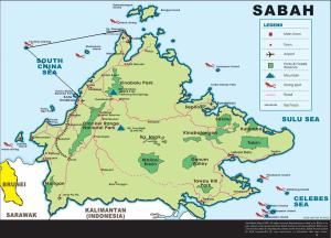
Travelling north from Bruneii and Labuan is definitely revisiting the past except this time we got to sail back to KK in a brilliant following breeze, well 25 knots that had the locals ducking for cover behind every island. Back in KK the word was engine repairs and yet again pondering heat exchangers and a crew change with Lasse leaving and German Sebastian coming on for the passage across the Celebes Sea to Davao in the Philippines.  Before all of this though we decided to head out to Gaya for some diving and beach timeand to see if we could sneak past the enjoyment police at the resort, without paying for multiple guides to follow us around on the national park tracks. Simon was with us this time to show us the sneaky way past the resort people but to no avail as when we were spotted they couldn’t understand Lasse’s Swedish or for that matter  Geoff’s Welsh, no surprises there really! So it was off on the national park tracks (the guides are really to allow you through the resort it seems) and a visit to the resort, forest, canopy walk.

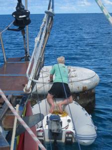
Spot their new mooring!!

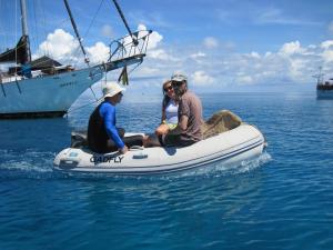
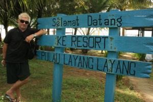
We had come through here a year or so earlier and whilst managing to get a swim in the resort pool and even being given a free cocktail (quite accidental on the resorts part) we were told very clearly to anchor to the sides of the bay. It seems a view of grotty yachties and their boats detracts from the whole resort experience or something.  So to avoid any angst we slipped  over  to  the south side of the bay and Trevor parked the Gadfly on the mooring that we had swung on last time before heading for Layang Layang; in this case a nice fat rope attached to a big-arse coral pinnacle on the bottom. Sadly the coral wasn’t up to the job as that night a squall to take ones breathe away hit us and with the boat nearly on it’s side in 50 knots of wind the mooring let go. Bit of a worry really, 2.30 in the morning, pitch black and in wind and rain one cannot look into the boat is bouncing up and down on the reef. Well when in doubt look for sea room so off into deep water we went dragging the bottom of the boat across the reef only to work out we still had a sodding great lump of coral hanging from the front of the boat, oh joy. To make matters worse our snubbing rope was now tangled in the mess of mooring line giving the appearance of a ‘Gordion’ knot. Ah well, these squalls do blow themselves out so eventually with the wind subsiding we deposited the resort’s mooring in a new location and went on the pick in the middle of their bay.

Lankayan.

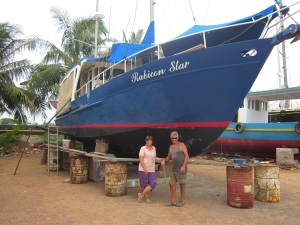
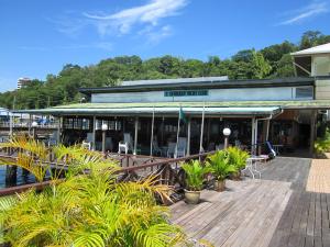
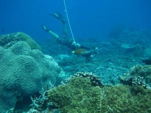
Back in KK after sorting various repairs and some new awnings for the cockpit we headed north hopefully for some diving with the new Hookah (surface supply compressor). It was also back into some old haunts of Lankayan , Sandakan and Kudat where we caught up again with the Rubicon Starlets (Tim and Barb). On Lankayan they had built a great big and beautiful new restaurant and bar just for us it seemed and we spent a couple of days here snorkelling, diving and seeing the sights. Sandakan of course remained the same right down to the foul ground and fasteners out in front of the yacht club. Last time we were here the anchor was turned inside out courtesy of some fishermen helping extract it and sure enough this time we fouled again, this time on whopping great sunken fishing boat.  We were actually anchored well clear of all the fasteners but dragged in a squall and spring tides and after dragging into the , tide changes figure-eighted the chain a couple of times in and over the wreck. Geoff had a go at getting it off first and came up rather wide eyed as there really is nothing like diving in zero visibility, with current, on a wreck with all sorts of ‘things’ washing past; south-east Asian ports are not the most aesthetically pleasing places to dive in. We eventually got our chain off with Trevor grovelling around on the bottom wrestling chain from behind steel plates and fishing nets and in the dark although one doubts the bottom here has seen sunlight for a long time anyway.  Handy to have the hookah at this point and all but in the absence of a full-face mask there was considered thought to what new vaccinations might be in order!!
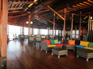
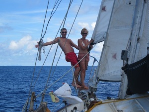
The Rubicon Stars!

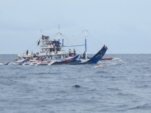
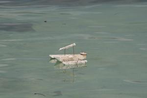
Moving east was back through familiar territory, Dewhurst Bay, Tambisan, TunSakaran and Semporna. We did head direct from Tambisan towards Davao but a friendly Philippino fisherman suggested we shouldn’t go past a couple of islands as “they are pirates”, “very bad people”, “Abu Saiaf”; okay we will go the other way back to Semporna! So a few days later it was off on the 400 odd miles across to Davao and back into the Philippines. This involved three nights at sea in what was pretty calm and easy conditions except for hundreds of unlit navigation hazards. Daryl on Metana had given us a heads up on this and it seems this whole part of the Celebes Sea is used for fishing with FAD’s or Fish Attraction or Aggregation Devices. There are hundreds of them, whopping great steelbouys about 6 metres long and anchored in anything from 100 to 5000 metres of water. Local fishermen work the FAD’s with boats all over the place including one fellow 20 miles offshore in his rather small ‘banka’ asking us if we wanted to buy his dolphin fish. It seems the dolphin fish hang around the bouys and assorted palm fronds and such things that the fishermen attach to the bouy and rope underneath. At night these things are a worry, they only paint up on radar in smooth water at about half a mile and even when a fishermen is tied up at night to one, they only turn their light (flashing disco style) on when they a see a boat close by. Apparently they don’t want to flatten their batteries, makes interesting night passages in this part of the world!!

Fishing boats at night! Quite random!

Tun Sakaran. Good place to anchor. Sea Gypsy territory.

Watch out for the pirates.

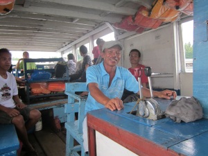
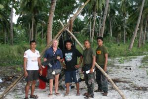
First port of call on this new Philippino adventure was Bulot Island at the bottom of the Davao Gulf, a visit to the town then some of the islands for snorkelling, swimming and visiting the locals. At the island across from Bulot the locals were very keen to investigate (don’t see too many yachts in these parts it seems) and we eventually had half of the little beach community on the boat for lunch. They even helped us clean the water line on Gadfly and thereforegave us  an opportunity to give away ‘cargo’ that meant much to them and good kharma for us; old sunglasses, monofilament not used for two years, old ropes, redundant stainless pots and crab traps amongst other things; these are very poor people.  We day hopped the hundred odd miles into Davao eventually going into the marina at the top of Samal Island just over the water from Davao town. Not many good anchorages here as the beaches are all quite steep to with deep water. Did let us see how the locals get by though and when swinging on a postcard of shallow water near the reef in one bay we could watch the locals carting on their backs loads of copra (coconut husk) in sacks to lighters that then carried the sacks to boats further out. They do it tough in this part of the world. On other boats here the ferries across from Samal are interesting with an ‘engineer’ sitting aft responding to the helmsman via a ‘telegraph’, in this case a steel bar banging on a metal pipe when the helmsman tugs on a piece of string; love it!
The Spanish have a lot to answer for!!

Cargo!

Of course as always on ones own boat boats things rarely go according to plans and in this case after arriving at the Samal marina Trevor decided to work out what that oil leak was all about. Well we arrived on the Wednesday and on Friday we pulled the engine out of the boat, ah yes, boat maintenance in exotic locations. Sorry about the delay in news. Cheers from the Gadfly.

Fish Attraction (or Aggregation) Devices.‘FADs’.

A fish aggregating (or aggregation) device (FAD) is a man-made object used to attract ocean going pelagic fish such as marlin, tuna and mahi-mahi (dolphin fish). They usually consist of buoys or floats tethered to the ocean floor with concrete blocks. Over 300 species of fish gather around FADs. FAD’s attract fish for numerous reasons that vary by species.Fish tend to move around FADs in varying orbits, rather than remaining stationary below the buoys. Both recreational and commercial fisheries use FADs.

Before FADs, commercial tuna fishing used purse seining to target surface-visible aggregations of birds and dolphins, which were a reliable signal of the presence of tuna schools below. The demand for dolphin-safe tuna was a driving force for FADs.

Fish are fascinated with floating objects. They aggregate in considerable numbers around objects such as drifting flotsam, rafts, jellyfish and floating seaweed. The objects appear to provide a “visual stimulus in an optical void”, and offer some protection for juvenile fish from predators. The gathering of juvenile fish, in turn, attracts larger predator fish. A study using sonar in French Polynesia, found large shoals of juvenile bigeye tuna and yellowfin tuna aggregated closest to the devices, 10 to 50m. Further out, 50 to 150m, was a less dense group of larger yellowfin and albacore tuna. Yet further out, to 500m, was a dispersed group of various large adult tuna. The distribution and density of these groups was variable and overlapped. The FADs were also used by other fish, and the aggregations dispersed when it was dark.

Drifting FADs are not tethered to the bottom and can be natural objects such as logs or man-made.

Moored FADs occupy a fixed location and attach to the sea bottom using a weight such as a concrete block. A rope made of floating synthetics such as polypropylene attaches to the mooring and in turn attaches to a buoy. The buoy can float at the surface (lasting 3–4 years) or lie subsurface to avoid detection and surface hazards such as weather and ship traffic. Subsurface FADs last longer (5–6 years) due to less wear and tear, but can be harder to locate. In some cases the upper section of rope is made from heavier-than-water metal chain so that if the buoy detaches from the rope, the rope sinks and thereby avoids damage to passing ships who no longer use the buoy to avoid getting tangled in the rope.
Samal Island. Holiday Oceanview Marina!

Love the engineers telegraph!

Philippino taxi ornamentation.

The engineer.

Swimming in Mud. Kota Kinabulu to Brunei May 13-30 (2012).

June 15, 2012

Royal Brunei Yacht Club.

At the Royal Brunei Yacht Club at Muara in Brunei (about 20 miles from town), they don’t sell beer. In fact like the rest of Brunei they don’t sell any alcohol at all. Instead intrepid yachties need to bring their own grog with them or put up with an extremely dry argument. You see they are quite Moslem here and the Sultan is none too keen on alcohol so the place is dry (well if you look really hard you might find it somewhere!!).  However, only 20 miles away across the water is Labuan, a duty free port that sells the cheapest alcohol in Indonesia, Malaysia or Thailand; we will leave the Philippines out here given the Aus$1.50 bottles of Rhum and Gin available there! The arrangement here is that those boaty types who hang around for a while, every now and again do a mercy dash across the water and bring back enough grog to possibly float their boat. Fortunately for all concerned at the RBYC the locals have an arrangement where those heathen enough to drink and those lacking adequate religious substance (or both) can bring their own beer ashore (best in your own bucket also) and the bar will provide you, free of charge, ice to chill your beer; perfect. It doesn’t really help the Philippinos who are working here (and having to quite unwillingly ‘go on the wagon’) go about getting a drink, but knowing the drinking proclivities of most yachtie types these guys have dramatically improved their English skills with phrases like “got any rum”, “what about gin”, yes “brandy will do”! It was either that, buy a boat or swim.

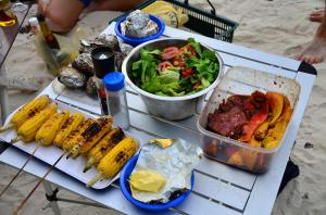
We are in Brunei chasing the cheap diesel after hanging around in Labuan getting the cheap beer. We slipped away from KK on the fifteenth with Welsh Jeff and Hilary on semi retirement from the UK, Swedish Lasse backpacking as far as he can and Trevor of course trying to keep on top of boat maintenance. First port of call was the old haunt of Police Bay and the obligatory BBQ on the beach. The big item here though was testing out the new ‘Hookah’, or for those non-diving types, the new ‘low-pressure surface supply compressor’. Trevor had been building this for the past week in KK with help from ‘Charlie’, the aluminium welder from Inanam (KK industrial area) who usually specialises in fabricating aluminium bits aimed at making small cars go as fast as possible. Building this had been quite a saga that fortuitously coincided with Gini coming out from Australia and carrying around 20 kilograms of compressor parts; no surprises really that Simon was more than happy for Amanda to go back to Aus for a couple of weeks and do the same! Anyway the new gear is running swimmingly heralding a whole new phase in diving capabilities. Whilst at Police Bay (Pulau Gaya) we were also reacquainted with that brilliant aspect of Sabah tourism, “no you can’t possibly go for a walk in the forest on your own”, “it is far to unsafe” and “for your own safety, we will give you a guide for 200 Ringgit”, (Aus$70). Unfortunately this seems to be becoming the norm here where travellers and tourists are charged large sums for even the mundane and up to six times what the locals are for anything more than mundane. We just might have to sneak past their resort when we go back that way!

Panel 5

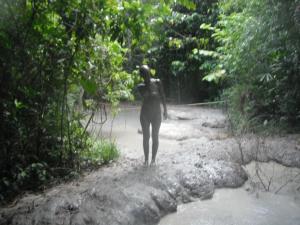
From Gaya to Pulua Tiga is about 35 miles with the opportunity at the end of the day to jump in mud. Tiga is a national park with a small resort of sorts, the obligatory diving operation and a ‘mud volcanoe’. You simply walk up the track behind the resort, go about 1.5 km, jump in the mud, float around for a while then walk down the beach to wash it off. Of course there is a sign advising all yachtie types to register at an office somewhere but you then probably run the risk of having to pay to take a guide with you, for your own safety of course, before you jump in the mud. The locals here trumpet the mud as good for your skin, health, complexion and as a remedy for most skin afflictions. It must be a bit of a girl thing these mud baths though as Hilary was more than happy to embrace the concept, porpoising around in the outdoor health spa. For your trusted blogger however the concepts of ear infection, conjunctivitis and parasites come to mind as possibilities; god knows what the locals might do with their mud to take the piss out of the punters. Washing the stuff off took more than a while as well and we all probably still have mud in our ears; we are sure Jeff has gone a bit deafer since.

Amphibious again it would seem!

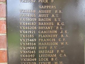
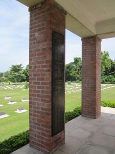
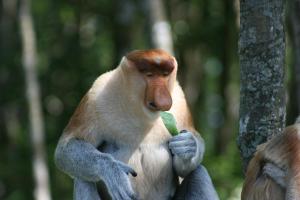
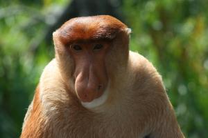
The next forty miles took as back to Labuan and with the new crew another day of running around checking out the same locations as July last year; they haven’t changed but we did get to marvel once again at the plastic fish in the Marine Museum. It meant also that we could locate the plaque with Jenny’s (the librarian) uncle Jack’s name on it; ‘John Kenneth Cameron’. Jack died on the Sandakan death march and is remembered in the Labuan war cemetery on Panel 5, soldiers with unknown graves. His grave might be unknown but with the number of unidentified soldiers in the Labuan cemetery he is probably there. Adjacent to Labuan over on the mainland and just 10 miles away is the entrance to the Klias River. This is a navigable river with water deep enough to take a keel boat 26km up until a set of power lines blocks any further moves north. There are several rivers like this in Borneo where boats are actually a normal form of transport especially the Rajang back in Sarawak and the Kinabatangan over near Sandakan. When one says transport on the longer rivers though, what you are really doing is considering moving yet more logs downstream from the rapidly disappearing rain-forest! We spent three days up the Klias checking out some of the smaller tributaries, yet more proboscis monkeys and the bird life. Interesting concept it is, trundling along a river with banks at times no more than twenty metres apart and cars passing on a highway half a kilometre away. A lot of fun but as for the Kinabatangan, just past the forest on the banks when there are hills, you can see the palm oil marching off into the distance. After the Klias we also went to the bird sanctuary at the top of Labuan and then went out to try and dive on the war wrecks out the other side of Pulau Kumaran; but without a marker on the wrecks we probably need some better tools to locate them.

Thyme headed north.

Brunei itself is probably one of the more affluent parts of SE Asia (excluding Singapore). Here the locals have the highest pay rates for this part of SE Asia, there is no real poverty, nobody starves, they pay no income tax and most infrastructure is provided by the Government, i.e. the Sultan who would appear to have a very definitive interest in keeping his subjects happy. It is also a bit dull, no bars of course, no theatre, not much of anything really and unbelievably for Asia there is it seems only one Karaoke place (can’t say bar) apparently fully equipped with signs prohibiting touching; wonder if the men sing love songs to each other here? The affluence of Brunei has come from oil of course but with no more oil to export and gas being the big financial provider one does wonder what will happen when the money starts to run out; one doubts that it will worry the Sultan’s family too much.

We are due to get away from here the day after tomorrow after a visit to town and a look at the water village housing around 30,000 people, wonder what they do with their sewage, nasty thought that one. From here it will be some food shopping in Labuan, diving on Tiga, diving and BBQ on Gaya then back to KK for some more boaty work. After that north for Kudat, back to Sandakan then east headed for Indo and the Philippines.

To drown in mud you would have to be held under or wear a very heavy weight belt!

Mud Volcanoes

A mud volcano may be the result of a piercement structure created by a pressurized mud diapir which breaches the Earth’s surface or ocean bottom. Their temperatures may be as low as the freezing point of the ejected materials, particularly when venting is associated with the creation of hydrocarbon, clathrate-hydrate deposits. Mud volcanoes are often associated with petroleum deposits and tectonic subduction zones and orogenic belts; hydrocarbon gases are often erupted. They are also often associated with lava volcanoes; in the case of such close proximity, mud volcanoes emit incombustible gases including helium, whereas lone mud volcanoes are more likely to emit methane.

Approximately 1,100 mud volcanoes have been identified on land and in shallow water. It has been estimated that well over 10,000 may exist on continental slopes and abyssal plains.

Philippines

In the Turtle Islands, in the province of Tawi-Tawi, the southwestern edge of the Philippines bordering Malaysia, presence of mud volcanoes are evident on three of the islands – Lihiman, Great Bakkungan and Boan Islands. The northeastern part of Lihiman Island is distinguished for having more violent kind of mud extrusions mixed with large pieces of rocks, creating a 20-m (66-ft) wide crater on that hilly part of the island.  Such extrusions are reported to be accompanied by mild earthquakes and evidence of extruded materials can be found high up the surrounding trees. Submarine mud extrusions off the island, have also been observed by local residents.

Other Asian locations

China has a number of mud volcanoes in Xinjiang province.

There are also mud volcanoes at the Arakan Coast in Myanmar (Burma).

There are two active mud volcanoes in South Taiwan, and several inactive ones. The Wushan Mud Volcanoes are located in the Yanchao District of Kaohsiung City.

There are mud volcanoes on the island of Pulau Tiga, off the western coast of the Malaysian state of Sabah on Borneo.

A drilling accident offshore of Brunei on Borneo in 1979 caused a mud volcano which took 20 relief wells and nearly 30 years to halt the eruption.

Lusi (Indonesia)

Drillingor an earthquakemay have resulted in the Sidoarjo mud flow on May 29, 2006, in the Porong subdistrict of East Java province, Indonesia. The mud covered about 440 hectares, 1,087 acres (4.40 km2) and inundated four villages, homes, roads, rice fields, and factories, displacing about 24,000 people and killing 14. The gas exploration company involved was operated by PT Lapindo Brantas and the earthquake that may have triggered the Mud Volcano was the Yogyakarta earthquake of May 27, 2006. In 2008, it was termed the world’s largest mud volcano and is beginning to show signs of catastrophic collapse, according to geologists who have been monitoring it and the surrounding area. A catastrophic collapse could sag the vent and surrounding area by up to 150 metres (490 ft) in the next decade. In March 2008, the scientists observed drops of up to 3 metres  in one night. Most of the subsidence in the area around the volcano is more gradual, at around 0.1 centimetres (0.039 in) per day. A study by a group of Indonesian geo-scientists led by Bambang Istadi predicted the area affected by the mudflow over a ten year period.More recent studies carried out in 2011 predict that the mud will flow for another 20 years, or even longer. Now named Lusi – a contraction of Lumpur Sidoarjo, where lumpur is the Indonesian word for “mud” – the mud volcano appears to be a hydrocarbon/hydrothermal hybrid.

An Island Somewhere. Bombonon to Kota Kinabulu via the Cagayens: April 04-May12 (2012)

June 10, 2012

From Bombonon to Puerto Princessa is around 300 miles; that is if you go north up the coast of Negros to Sipilay and then run west, pretty much across the middle of the Sulu Sea. Most of the other boaty types that we know were going further north and day hopping up through Cuyo, but what with Gini on board and her longing for a trip to the Kinabatangan River over near Sandakan, the pressure was on to move a bit faster than usual and head south back into Sabah. We were down to two crew for the next month, Gini back to escape for a whle the approaching winter in Tasmania and getting back to PP with all haste was going to require at leat two overnighters after we cleared away from the Negros west coast. The good thing here though was we would no longer be pushing hard against tradewinds but hopefully picking up some of the last of the NE monsoon (Amihan) or at least get the transitional variables. So after about three weeks of idle lassitude, beach Karaoke (and normal boat repairs) we slipped out past the fishing boats at the Bombodon entrance, waved good-bye to Nigel and the bar by the water and headed west then north-west for a day hop to Sipilay. By the way, the beach bar Karaoke here was a scream, half a dozen Philippino fishermen sitting in a dirt floor bar drinking copious quantities of Rhum, not a woman in sight and all taking it in turns to sing love songs to each other; just brilliant.

We spent a couple of days above Sipilay at Cartegena Beach north of town and decided our lives wouldn’t be complete if we didn’t visit ‘Coral Beach’, described in a well known travel guide as one of the star beach attractions in SE Asia. Finding the place became a bit of a dilemma with our tricycle driver getting comprehensively lost along the way and then having to get a (banka) ferry ride to get there. After our visit we were left to marvel at the creative nature of travel book writers and to ponder what incentives those travel writing, researching, back-packer types get paid to write some of their stuff, enough said!!! The next day bright and early (2.00 AM) it was off for the longest hop of our Sulu Sea sojourn with a longish run of 150 miles to the Cagayens way out on their own in the middle of nowhere. The departure was great, pitch black, dodge the fishing boats and do not run onto the reef in the middle of the bay. Of course for our two days the wind went quite variable, all over the shop really requiring just about every combination of sails and trim imaginable; at least it wasn’t on the nose for the trip. The word here though is hot. Think of hot in the back of a boat then try and think even hotter, yea and then hotter again. With the sun frying our transom, rising as usual in the east and us running west, the only way to survive was temporary awnings using the dinghy cover. Nigel was on the money when describing the transition as the summer and bloody hot. Apparently this part of the world up until a few years ago was also something of a no go zone for many yachties with the ‘pirates’ chasing away any brave soul that ventured out on the water. Well at least that’s how it comes across from the locals when you talk to them although Nigel has been up this way for years and hasn’t at this point suffered any piratical outrage. There is of course the possibility that the stories are somewhat apocryphal or that after raising enough money the pirates are at home enjoying hard earned air-conditioning!

Anyway after two days of sailing sauna we got our first sight of the Cagayens and wondered whether our waypoints would get us into the lagoon. The charts here have an offset of around a quarter mile (500 yards) and when one plots the GPS latitude and longitude directly onto the electronic charts you end up running across the reef and eventually onto dry land behind the village; somewhat disconcerting. Of course the appropriate course of action would be to get out a paper chart and plot ones entrance using a compass, but when in Rome as they say, trust the force and follow the fishermen. So after seemingly running across the reef and becoming quite amphibious we dropped the pick in front of the town pier just in time to see most of the towns people jumping onto large banka’s’ (big Philippino style, outrigger, spider boats) and leaving. Initially we thought that perhaps we had offended everybody without even trying but then discovered that we had arrived in ‘Holy Week’ (basically Easter) and after doing the family thing half of the islands population was going on holidays for a few days.

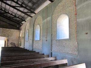
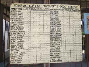
Great place the Cagayens, clear water, reef to snorkel on, a really cool village to check out and aside from some diving types on live-aboard banka’s’, not a tourist in sight. The town here has to be one of the cleanest you could find in SE Asia and spectacularly different to the open tip and rubbish strewn waterways we had seen in many parts of Indonesia and Malaysia. At the local church (they are quite religious here but somewhat flexible on their application of religious pursuit….), they even keep score on how the local congregation is managing in the tidiness and sustainability stakes. Out in the lagoon there is the mandatory seaweed farm (Calerpa racemosa) and according to that guide book again, the main diet out here is fish and seaweed, shades of the sea-gypsies; the town is of course much more salubrious and not nearly as poverty-stricken as that guide book makes out.  There is a huge Spanish-Colonial church here that the locals are fixing up, interesting walls with hundreds of large sea-shells embedded in the mortar rendering. There is also the worlds smallest ambulance that for any average westerner would require amputation of ones feet before getting in. The locals still draw their water here from wells and after watching the water carriers it became very clear why it’s handy around these parts to have children.

The next part of our Sulu-Sea sojourn was the hundred odd miles across into PP running again almost due west trying to find somewhere to hide from the sun. This was another overnighter with an arrival nice and early into Abanico and a revisit of the old haunts of Puerto. Thyme (Simon and Amanda) and Rubican Star (Tim and Barbara) were not far behind and after getting in we were all forced to check out some of the local nightspots; Gini starred here with her cave-woman routine literally dragging Trevor (on his back) to the dance floor while Tim’s secret hippie background was on display with his attraction to the bands Bongo drum. A week later it was southward bound for another 300 miles in company with Thyme and island hopping back into Malaysia. More beaches, more villages, more pearl farms more sea-gypsies. After stops on Sombrero Island, Arrecife Island and Brookes Point we had plotted a night off Bowen Island, north of Bugsuk. Unfortunately we weren’t terribly welcome here and the pearl farm security very nicely and with many smiles escorted us through their farm to Pandanan Island five miles further west. It was explained of course that this was for our own safety (this is the standard line in this part of the world when the authorities or others want you to go away) and we weren’t inclined to argue too vociferously given the large piece of artillery the security guide was carrying (M14, big bullets and no photos allowed).

Next island on the southward progression was Candaraman, almost out of the Philippines and a few drinks for Trevor’s birthday. We had arrived here in the middle of  a ‘Christian Youth Camp’ although the local Parish Priest explained that anybody up to 45 was welcome as long as they were single; he explained that they patrolled the sleeping area and tents to make sure the genders stayed separate!!!  We were down into part of the more Moslem area of the Philippines and the army and police had a presence at the camp to discourage any ‘trouble’ although there “is no trouble around here”. Probably not very likely given the serious amount of hardware stacked in the trees next to the military and police hummocks. Next day it was off to Balabangan in Malaysia and an evening and morning thinking of things to give to the sea-gypsies; petrol, soap, apples, biscuits…etc etc etc. Thyme bid their farewells here heading for Kudat and new crew while the good ship Gadfly slipped around the most northerly point of Borneo and headed south for a one hundred mile overnight run into the Sutera Harbour Marina at Kota Kinabulu.

The plan at KK was to leave the boat and travel overland to the Kinabatangan River and Sandakan where Gini would take lots of photographs of every animal that passed in front of her camera.  There are a number of ecolodges along the Kinabatangan River where tourists can go to check out what’s left of some of the previously abundant and spectacular Borneo wildlife, orangutans, monkeys, elephants, birds, deer and so on and the visitors get taken on river cruises, day walks and night spotlighting trips. The trouble is that most of the rain-forest (jungle) has been removed, logged and then replanted with palm oil and what one sees is small remnant forest areas along the margins of rivers or isolated refuges around sites such as the Nyah Caves Park inland from Miri. The Kinabatangan elephants might be easy to keep track of but no surprises there really as most of their habitat has been destroyed and they have to stay next to the river. There are orangutan refuges and shelters at a number of places (Sepilok at Sandakan) with no shortage of animals as their habitat is being constantly destroyed and the orangutans are shot or persecuted if they walk into the palm oil plantations. These isolated and fragmented forest areas are also a problem for the larger mammals and especially apex predators of the forest as there is no opportunity for them to move between locations and the loss of habitat and fragmentation of the forests places survivors under significant (environmental) stress from multiple sources. The smaller mammals, birds and bats may manage to adapt but for the larger animals there is probably insufficient range to maintain long-term, viable breeding populations (not to mention loss of genetic diversity). Sadly this is the trend and a problem for most of SE Asia.

At the Tungog Rainforest Ecocamp, the guides speak in awe of the Australian fellow ‘Martin’ who had worked with the locals for 15 odd years to establish the ecocamp and encourage the locals to embrace nature based tourism and homestays as an industry involving their forest. Martin has been back in Australia for several years and since he has left stands of forest adjacent to the river and near the bridge at the ‘Kinabatangan’ village have been cleared and planted with palm oil. The locals in the meantime are growing seedlings, attempting to rehabilitate nearby, degraded areas and expressing interest in buying back areas to re-establish forest.  They explain that it is the ‘Chinese’ who are doing most of the damage but couldn’t elaborate as to whether that meant ethnic Chinese Malays, Singaporean Chinese, or Mainland Chinese. At the ‘Lubuk Bay’ Proboscis Monkey refuge near Sandakan the Chinese owners have made a video extolling their virtues for saving the Proboscis Monkeys in the area, this after they cleared the area to grow palm oil leaving a tiny fragment of habitat for the monkeys, habitat no doubt unsuitable for palm oil; quite staggering really. In the meantime the video they have produced waxes lyrical about the abundant rainforests that “stretch from the mountains to the seas of Borneo”, not to mention adjacent seas that apparently teem with huge schools of massive fish, clearly now fish and forest figments of somebodies imagination!  They also charge twenty dollars (Aus or US) a person to enter their ‘refuge’ and three dollars more to take photographs (one does wonder where the money goes but doubts it is going to forest rehabilitation). Still it is worth having a look at those parts of what was once a spectacular ecosystem and hope that common sense might one day prevail over greed and corruption. In the meantime the Government and operators in Sabah are selling tourism packages on the basis of come and see our abundant wildlife, spectacular forests and magnificent diving; just pay heaps and don’t look too hard!

After our river sojourn it was back to KK and Gini’s departure for her PhD program back in Tasmania researching Tasmanian Devils and Quolls. Fortunately her flight was cancelled and she was forced to stay another five days until the twelfth when Jeff, Hilary and Lasse arrived; new crew for southward moves to Labuan and Brunei.

Habitat fragmentation


As the name implies, ‘habitat fragmentation’ describes the emergence of discontinuities (fragmentation) in an organism’s preferred environment (habitat), causing population fragmentation. Habitat fragmentation can be caused by geological processes that slowly alter the layout of the physical environment (suspected of being one of the major causes of speciation]), or by human activity such as land conversion, which can alter the environment much faster and causes extinctions of many species.

The term habitat fragmentation includes five discrete phenomena:

Reduction in the total area of the habitat

Decrease of the interior : edge ratio

Isolation of one habitat fragment from other areas of habitat

Breaking up of one patch of habitat into several smaller patches

Decrease in the average size of each patch of habitat

Habitat fragmentation is frequently caused by humans when native vegetation is cleared for human activities such as agriculture, rural development, urbanization and the creation of hydroelectric reservoirs. Habitats which were once continuous become divided into separate fragments. After intensive clearing, the separate fragments tend to be very small islands isolated from each other by cropland, pasture, pavement, or even barren land. The latter is often the result of slash and burn farming in tropical forests. In the wheat belt of central western New South Wales, Australia, 90% of the native vegetation has been cleared and over 99% of the tall grass prairie of North America has been cleared, resulting in extreme habitat fragmentation.

One of the major ways that habitat fragmentation affects biodiversity is by reduction in the amount of available habitat (such as rainforests, boreal forests, oceans, marshlands, etc.) for all organisms in an ecological niche. Habitat fragmentation invariably involves some amount of habitat destruction. Plants and other sessile organisms in these areas are usually directly destroyed. Mobile animals (especially birds and mammals) retreat into remnant patches of habitat. This can lead to crowding effects and increased competition.

The remaining habitat fragments are smaller than the original habitat. Species that can move between fragments may use more than one fragment. Species which cannot move between fragments must make do with what is available in the single fragment in which they ended up. Since one of the major causes of habitat destruction is agricultural development, habitat fragments are rarely representative samples of the initial landscape.

Area is the primary determinant of the number of species in a fragment.The size of the fragment will influence the number of species which are present when the fragment was initially created, and will influence the ability of these species to persist in the fragment. Small fragments of habitat can only support small populations of plants and animals and small populations are more vulnerable to extinction. Minor fluctuations in climate, resources, or other factors that would be unremarkable and quickly corrected in large populations can be catastrophic in small, isolated populations. Thus fragmentation of habitat is an important cause of species extinction. Population dynamics of subdivided populations tend to vary asynchronously. In an unfragmented landscape a declining population can be “rescued” by immigration from a nearby expanding population. In fragmented landscapes, the distance between fragments may prevent this from happening. Additionally, unoccupied fragments of habitat that are separated from a source of immigrants by some barrier are less likely to be repopulated than adjoining fragments. Even small species such as the Columbia spotted frog are reliant on the rescue effect. Studies showed 25% of juveniles travel a distance over 200m compared to 4% of adults. Of these, 95% remain in their new locale, demonstrating that this journey is necessary for survival.

Additionally, habitat fragmentation leads to edge effects. Microclimactic changes in light, temperature and wind can alter the ecology around the fragment, and in the interior and exterior portions of the fragment. Fires become more likely in the area as humidity drops and temperature and wind levels rise. Exotic and pest species may establish themselves easily in such disturbed environments, and the proximity of domestic animals often upsets the natural ecology. Also, habitat along the edge of a fragment has a different climate and favours different species from the interior habitat. Small fragments are therefore unfavourable for species which require interior habitat.

Habitat fragmentation is often a cause of species becoming threatened or endangered. The existence of viable habitat is critical to the survival of any species, and in many cases the fragmentation of any remaining habitat can lead to difficult decisions for conservation biologists. Given a limited amount of resources available for conservation is it preferable to protect the existing isolated patches of habitat or to buy back land to get the largest possible continuous piece of land? This ongoing debate is often referred to as SLOSS (Single Large or Several Small).

One solution to the problem of habitat fragmentation is to link the fragments by preserving or planting corridors of native vegetation. This has the potential to mitigate the problem of isolation but not the loss of interior habitat. In rare cases a Conservation reliant species may gain some measure of disease protection by being distributed in isolated habitats. Another mitigation measure is the enlargement of small remnants in order to increase the amount of interior habitat. This may be impractical since developed land is often more expensive and could require significant time and effort to restore. The best solution is generally dependent on the particular species or ecosystem that is being considered. More mobile species, like most birds, do not need connected habitat while some smaller animals, like rodents, may be more exposed to predation in open land. These questions generally fall under the headings of metapopulations island biogeography.

(From Wiki…..).

Sandakan and the ‘8-mile camp’; anchors and trawlers. November 08-28, Sandakan to Kudat.

December 11, 2011

On the site of the big tree above the Australian camp.

Eight miles outside the town of Sandakan is one of the most melancholy places you might visit in Borneo. It’s easy to get to, just take a bus from in front of the market, get off after going past the ‘Giant’ supermarket at about 7 miles, then walk up the hill between the houses. Go past the community centre and turn right just after the new townhouse development. You will probably get funny looks from some of the locals walking down to the main road and from others who jog along the road and in the memorial park at the top of the hill; there after all aren’t that many non-Malaysians out here or tourists getting about on foot.

For that matter Sandakan doesn’t really rate very high in the tourist destination stakes except perhaps for people headed out via boat to go diving on island resorts like Palau Lankayan. In fact if it wasn’t for the Japanese occupation of Borneo during the second world war, the town of Sandakan might be just as unknown to Australians as places like Kudat, Miri and Lahud Datu. Instead, Sandakan sits high in the pantheon of Australian military history albiet for all of the worst reasons, and most Australians have probably heard some mention of it.

The Japanese in Sandakan in1942 in one of their standard moments of appalling behaviour decided to use Asian prisoners and Australian and British prisoners of war to build a new airfield to support their expanding empire. Some 3600 Asians and 2400 Australian (largely) and British troops were shipped in and by the end of the war almost all of the prisoners of war had died. By 1945 after two years of neglect and torment and just before the end of the war the Japanese for reasons they could only explain, decided that as the Australian army was approaching, those that were left and could walk would march through virgin jungle and swamp all the way across Borneo to Jesselton, now Kota Kinabulu; carrying Japanese supplies of course. None got to KK but some made it to Ranau, 260 km away on the flanks of Mount Kinabulu where, except for six Australian excapees, they stayed until moved to the war cemetery at Labuan. In most circles the ‘Sandakan Death Marches’ are widely considered to be the single worst atrocity suffered by Australian servicemen during the Second World War; not to mention the fate of British and Asian prisoners.

Jack Cameron.

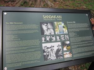
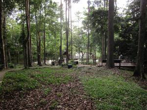
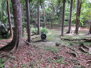
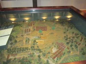
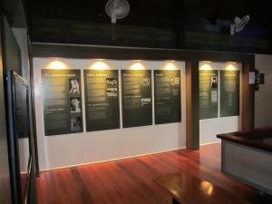
The ‘Memorial Park’ is on the site of the original ‘8-mile’ camp, largely where previously the Australian compound was situated with the memorial marker on the location of the big tree that used to stand above the Australian’s camp. Nowadays the area and park is a jungle/forest enclave with a small lake, boardwalks, signs explaining the past, and a memorial pavilion containing the standard pictures and accounts of what happened here along with a model of the camp.

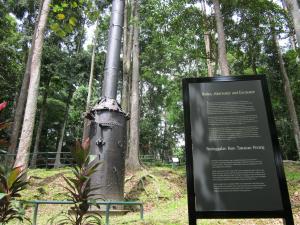
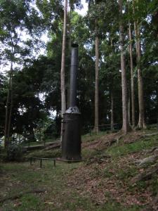
Little remains of the camp proper, the old boiler and alternator for providing lighting, an old excavator that hasn’t moved since being sabotaged by an enterprising but unknown Australian soldier; the site of the British compound is currently in the process of being built over by encroaching housing development. Inside the park the footpaths are perfect for the locals out for their afternoon jog while one must wait patiently for the visiting school groups to finish up before taking a few photographs. It’s in the pavilion and after reading the background and accounts of the few survivors that one is left with a very deep sense of sadness for those who thought that one day they might have made it home. Of course from sixty-five years after and without personal involvement it is difficult to really comprehend and engage with the scale and tragedy of what happened here. For others though it is much closer. Jenny (The Librarian), a friend from Melbourne has an uncle who died here; John (Jack) Kenneth Cameron, he died 15th May 1945. Jenny would like to visit but in her words, some photos would be nice. Jack is possibly in the war cemetery in Labuan, but many didn’t make it that far.

The ‘big tree’!

After visiting the 8-mile, further sightseeing around Sandakan did seem somewhat self indulgent so the next step was to get organised to head back around to Kudat and to then head north. The boat however, did need some work including new batteries and seats for the cockpit and eventually we were ready to leave on 20Nov; that is until we tried to pull our anchor up the day before. A week earlier at night during one of the usual squalls that slip through this part of the world we were almost mowed down by a German boat whose anchor was proving somewhat slippery. Given that Thyme also appeared to have moved around a bit, Trevor was somewhat suspicious that our anchor might have been attached to something more substantial than sand or mud.

The battery carriers.
Sylvie and the new seats.

After their evening of squall induced anchor dragging the Germans had later anchored unsuspectingly inside a sunken fishing boat and as suspected, it turned out that our anchor was attached to something formidable enough to defy all our and the local Police boats attempts at extraction by either diver or engine. The bottom here would appear to be a full on scrap-yard and fishing boat graveyard which with zero visibility, strong current and enormous amounts of submerged logs and rubbish makes for interesting diving.

Love the way they name boats here.

Big engines and bending the anchor!

The eventual answer for the Police was to press gang a fishing trawler to use their winching gear to extract our recalcitrant CQR. After breaking two sets of gear the answer became, we will tie the chain to the back of the trawler and pull the thing out; now these fishing trawlers are big, very heavy and have very big engines. In spite of Trevor’s pleas of don’t do it, they did manage to pull the thing out while completely redesigning the anchor and converting 10 metres of 3/8 short link chain to 5/16 long link. Next day was spent at the local engineering works converting the anchor back to something approaching its’ original shape.

Not supposed to look like that is it?

We eventually got away on the 21st, this time with Canadian Ron coming on for the trip around to Kudat then up to Puerto Princessa in the Philippines (never had heard of Puerto Princessa before coming up here). First stop was the Turtle Islands where we weren’t allowed to go ashore. At Lankayan we could go ashore but not on the beaches at night where we might see some turtles, we were told that this was for our own safety. While one wonders how fast those turtles can actually move we eventually decided this was more about the resort not making money from grotty-yachties. Well after some persuasion that night the local, Sabah Parks fellows relented and let us, that is crew from Gadfly, English Andy on Shah and the same Germans from Samba, go with them where we found a big turtle hauling out to lay her eggs. Problem here was that instead of laying her eggs she actually dug up another nest where the eggs were hatching which had us running about at two in the morning carrying little turtles to the water; though they really did actually seem to know the way without our help!

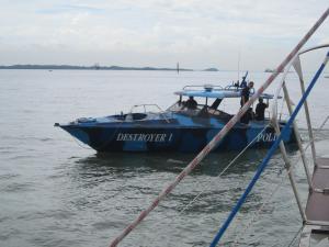
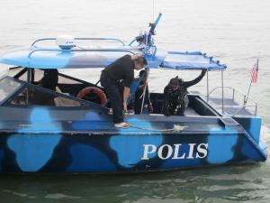
The next day from Lankayan we slipped across to Tigapil and beers that night with English Andy on his starship ‘Shah’, then a longer hop to Malawali before a good day of sailing the last thirty miles down into Kudat and the basin in front of the non-marina (never got built of course). We were in the Basin for a week, shopping, buying cheap beer from the Chinese, yet again fixing things and chatting to the Navy guys in their new, fast boats. Quite amazing really, six metre runabouts with mounts for four (yes four) 50-calibre machine guns. That’s really a lot of firepower for a biggish, potential fishing boat; wonder where they will put the rod holders?

Sandakan market.

These boats also carry two, two hundred and fifty horsepower outboard motors on the back making them without too much doubt probably the fastest and most heavily armed fishing boats getting about, but they probably need the horsepower. In Sandakan even the local fishing boats that they launch from the yacht club are not short on horsepower with twenty foot, flat bottom fishing boats (barges really) having as much as 500 horsepower of outboard motors hanging off their transom. This does make one wonder what the average smuggler or aspiring pirate might run around with?

The numbers say it all!!!
At the Sandakan Yacht club.

The program now after getting sorted in Kudat, was to day hop the 210 miles up the east coast of Palawan to Puerto Princessa stopping at nights of course in true cruising mode. The only problem with this plan though is that the direction we need to go is north-east and by now of course the north-east monsoon had set in. We had been regaled with tales of woe from a number of sources about the problems of moving north in December and the weather which had set in during our trip around from Sandakan seemed to support said woe; you will never get there, it will be horrible! Anyway, operating on the basis that ‘I bet it doesn’t blow hard all day and for that matter every day’, on 28 November after sitting through some really crappy weather we recovered our stern lines, pulled up our still working anchor and with the wind ENE at 5-10 we quietly slipped out headed north for Palawan and the Philippines; must be getting soft even worrying about the weather up here, can’t be that bad?

After the marches; (from Wikipedia).

Due to a combination of a lack of food and brutal treatment at the hands of the Japanese, there were only 38 prisoners left alive at Ranau by the end of July. All were too unwell and weak to do any work, and it was ordered that any remaining survivors should be shot. The prisoners were killed by their guards during August, possibly up to 12 days after the end of the war on August 14. In total, only six Australian servicemen managed to escape. During the second marches, Gunner Owen Campbell and Bombardier Richard Braithwaite managed to escape into the jungle, where they were assisted by locals and eventually rescued by Allied units. During July, Private Nelson Short, Warrant Officer William Sticpewich, Private Keith Botterill and Lance Bombardier William Moxham managed to escape from Ranau and were also helped by the local people, who fed them and hid them from the Japanese until the end of the war. Of the six survivors, only three survived the lingering effects of their ordeal in order to give evidence at various war crimes trials in both Tokyo and Rabaul. The world was able to receive eyewitness accounts of the crimes and atrocities committed. Captain Hoshijima was found guilty of war crimes and hanged on April 6 1946. Capt Takakuwa and his second-in-charge, Capt Watanabe Genzo, were found guilty of causing the murders and massacres of prisoners-of-war and were hanged and shot on 6 April 1946 and 16 March 1946 respectively.

Don’t think the weather is worth worrying about really!!!!

The Pirate Wind; Lahud Datu to Sandakan, October 30 – November 07

November 10, 2011

Piracy is only a sea term for robbery, piracy being a robbery committed within the jurisdiction of the Admiralty. If any man be assaulted within the jurisdiction and his ship or goods violently taken away without legal authority, this is robbery and piracy.” Later, “…to the most remote parts of the world; so that if any person whatsoever, native or foreigner, Christian or Infidel, Turk or Pagan, with whose country we have no war …. shall be robbed or spoiled in the Narrow Seas, the Mediterranean, Atlantic, Southern or any other seas …. either on this or the other side of the line, it is piracy within the limits of your enquiry and the cognisance of this court.” (Sir Charles Hedges, Judge of the High Court of (British) Admiralty, October 13. 1696).

In the 18th – 19th centuries in the waters around Borneo and especially in the waters of the Celebes, Sulu and South China Seas, a tradition of piracy developed that was so widespread it became quite the local, major industry. By all accounts it was also practised in such a violent and homicidal manner as to make your Spanish Main buccaneers (Pirates of the Caribbean) appear to be quite well behaved. Most everybody was involved in some way it seems as one was either or a pirate or not a pirate and if you weren’t a pirate then you were likely to be robbed, killed or enslaved by pirates, or get paid by pirates. It also became a major source of income for the various Sultanates, especially the Sulu and Bruneii Kingdoms where even their own people could be captured by pirates, have ransoms paid to obtain release then shortly after be taken again by other pirates; with commissions paid to ‘Government’ Officials. If a captive couldn’t obtain a release ransom they would almost certainly be sold into slavery. Bruneii nobles would buy slaves from one set of pirates while Bruneii people would be captured and enslaved by other pirate groups. If there was no room for slaves, captives might be hacked to death, decapitated, buried alive, burnt or killed by whatever methods of despatch the pirates dreamed up at the time. Killing with their swords or ‘Kris’ was a favoured option however as the wielder of the scythe got to put little brass or gold rivets on their weapon; numbers here were important.

Amongst the Sulu pirates it was said, “To catch a fish is hard, but it is easy to catch a Bruneii”. Piracy became eventually so entrenched in the Sulu kingdom to the north-east of Borneo, that the easterly winds that followed the SW monsoon became known in Bruneii as ‘The Pirate Wind’, as the pirate sailing vessels moved out of the Sulu sea toward Bruneii following the prevailing winds. One does gather however that in this part of the world and at the time, that the term might just as easily be applied to the SW monsoon by people who lived to the NE! Just a matter of perspective really.

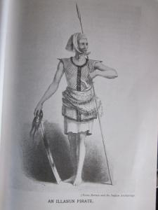
Not that there weren’t many tribal groups that weren’t involved in some way.  The Illanun and Balanini from Mindanau and the Sulu Archipelago were the biggest protagonists (with help from the Bajaus) but eventually many of the local river and sea  ‘Dayaks’ also became involved after serving apprenticeships in the Malayan war ‘prahus’. These Prahus would range from the Philippines to Sumatra to far NE Malaysia, often in fleets of up to 200 and in journeys such as circumnavigations of Island Borneo. They would prey on shipping and boats of all sorts, local foreign, large and small, at times challenge foreign warships (perhaps inadvisably) and also raid onshore for whatever was available and for slaves.  On Balambangan, an island just north of Kudat and in 1775 a Sulu pirate chief  ‘Datu Tating’ a first cousin of the Sultan even led a pirate attack and destroyed a British military settlement and stockade. The Dayaks of course applied their more bloodthirsty traditions to piracy with considerable enthusiasm and were just as happy hacking off peoples heads (anybody at all) as they were collecting swag.

While various foreign governments tried with limited success to reign in piracy in their various colonial realms, in Borneo it wasn’t until Sir James Brooke became the first white Rajah of Sarawak in1839 that the scale of piracy began to wane. Rajah Brooke exercised the standard levels of British diplomacy for the time and with help from Admiral Cochrane and the Royal Navy, Singapore squadron gave the pirates a lesson in ‘strength through superior firepower. While the Sulu Archipelago was left to the Spanish, the pirate strongholds in the river ports of Sabah, Sarawak and Bruneii succumbed in succession to the latest advances in colonial diplomacy involving, guns, cannons and soldiers.  The actual city of Bruneii also proved quite reluctant to withdraw from the financial benefits associated with piracy and in 1846 the Sultan was given an abject lesson in gunboat diplomacy!

Like elsewhere, piracy of course was never totally wiped out in this part of the world and piratical attacks have continued in various forms up to current times. We have in our sailing endeavours been hearing all forms of expression of concern from locals here, primarily telling us that we are very ‘brave’. However, while the locals tell us that there have been two attacks on shipping nearby this year we have yet to hear of any attacks on yachties in the recent past. To be honest there is not really that much to steal from the average yachtie, a couple of radios perhaps, some cameras and rice maybe; hardly compares to a cargo ship or shipping containers full of all sorts of good things. There were the attacks on tourist divers at Sipidan down past Semporna in 2000 where the locals from the Sulu archipelago decided to resurrect their forebears more questionable concepts of commerce. The result of this little incursion, robbery, abduction and murder, standard program really for your average ‘Moro’ pirate, is a police and military presence that is almost overwhelming. We were overflown twice by military surveillance aircraft near the Kinabatangan mouth on the way around from Lahud Datu and photographed by police while at anchor one morning.

Lahud Datu itself was we are told something of a pirate stronghold for years and the ‘Lonely Planet’ warns people about the perils of the seafaring life here; one wonders if the travel writer at the time even got on a boat or just listened to apophrical stories from locals. There are the stories of ten years ago pirates armed with automatic weapons robbing the bank at Lahud Datu and one of the teachers at the school on Tambisan tells us that the pirates made an attack on Tambisan in the nineties; wonder what they wanted from Tambisan, there isn’t a great deal there?

All things considered though, the Sulu Archipelago and Southern Mindanao are not on our list of places we are going to visit; there probably still be pirates there of some sort!

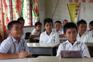
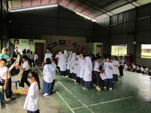
We got away from Lahud Datu on the 31st and on glassy seas motored to Tungku Vil, a sort of point with an inlet 38 miles to the east. Hot here so swimming and bombing demonstrations were the order of the day including British ‘back-slappers’ from Lucy and a face plant from Trevor. Dent haven was next 30 odd miles east and north leaving Darvil Bay. Next morning bright and early it was off from Dent to our old haunt of Tambisan and a look around at the local school and recently painted pre-school.  Simon here offered Trevor’s services to talk to the grade sixers in English (or at least Australian) and the teachers took this seriously enough that next morning all four of us sallied forth for our cultural interaction with Tambisan’s brightest. This excursion was undertaken under some difficulty after our Melbourne Cup celebrations and cocktail party of the previous evening.  For the record, Simon won the sweep while Trevor got second and third. Back at the school, after having the students all join in a rousing rendition of Waltzing Matilda and discussing why we would want to travel so far on little boats off we went to watch the launch of the latest initiative in English teaching, a mandatory 33 minutes of communal reading.

The teachers tell us that it is obligatory for them to video proceedings and submit the video to the central education department for verification, it seems they are serious about their English teaching. The school here serves locals from a few nearby communities including some more permanent, Bajau groups who commute, quite appropriately, on boats. It seems that in spite of their stateless nature the school on Tambisan still takes them in, unlike Mabul where they are not allowed to attend the school.  The Bajau here have taken up residence along waterways in more permanent fishing communities and apparently they get by bartering with their fish for whatever else they need.

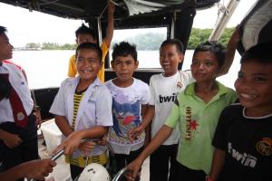
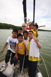
After our introduction to the Malaysian education system it was back to the boats in anticipation of a visit from the grade sixers who were dead keen to get a look inside the weird boats parked in their river; the strange white peoples boats come and go but none of the locals had ever seen the inside of one. So there we were giving the boys and girls of Tambisan a tour through our boats along with one of the teachers, the local boatman and one of the kids dads who happened to be passing by on his boat. They especially liked playing with the VHF radio and the chart plotter (lots of pretty pictures there) while the girls were fascinated with the on-board toilets. From Tambisan it was on to Dewhurst Bay and a revisit with the proboscis monkeys, then a 35 mile hop back to Sandakan to revisit the yacht club at Sandakan. Time for some new batteries, other boat fixes, a crew change and maybe a clearance to head direct to the Philippines.

Moro Pirates

The Moro Pirates, also known as the Sulu Pirates, were Muslim outlaws of the southern Philippines who engaged in frequent acts of piracy, primarily against the Spanish, beginning in the late 16th century. Because of the continual wars between Spain and the Moro people, the areas in and around the Sulu Sea became a haven for piracy which was not suppressed until the beginning of the 20th century. The pirates should not be confused with the naval forces or privateers of the various Moro tribes. However, many of the pirates operated under government saction during time of war.

The pirate ships used by the Moros were known as proa, or garays, and they varied in design. The majority were wooden sailing galleys about ninety feet long with a beam of ten feet. They carried around fifty to 100 crewmen. Moros usually armed their vessels with three swivel guns, called lelahs or lantakas, and occasionally a heavy cannon, proas were very fast and the pirates would prey on merchant ships becalmed in shallow water as they passed through the Sulu Sea. Slave trading and raiding was also very common, the pirates would assemble large fleets of proas and attack coastal towns. Hundreds of Christians were captured and imprisoned over the centuries, many were used a galley slaves aboard the pirate ships.

Other than muskets and rifles, the Moro pirates, as well as the navy sailors and the privateers, used a sword called the kris with a wavy blade incised with blood channels. The wooden or ivory handle was often heavily ornamented with silver or gold. The type of wound inflicted by its blade makes it difficult to heal. The kris was used often used in boarding a vessel. Moros also used a kampeli, another sword, a knife, or barong and a spear, made of bamboo and an iron spearhead. The Moro’s swivel guns were not like more modern guns used by the world powers but were of a much older technology, making them largely innacurate, especially at sea. Lantakas dated back to the 1500s and were up to six feet long, requiring several men to lift one. They fired up to a half-pound cannon ball or grape shot. A lantaka was bored by hand and were sunk into a pit and packed with dirt to hold them in a vertical position. The barrel was then bored by a company of men walking around in a circle to turn drill bits by hand.

The Spanish engaged the Moro pirates frequently in the 1840s. The expedition to Balanguingui in 1848 was carried out by Brigadier José Ruiz and a fleet of nineteen small warships and hundreds of Spanish Army troops. They were opposed by at least 1,000 Moros held up in four forts with 124 cannons and plenty of small arms. There were also dozens of proas at Balanguingui but the pirates abandoned their ships for the better defended fortifications. The Spanish stormed three of the positions by force and captured a remaining one after the pirates had retreated. Over 500 prisoners were freed in the operation and over 500 Moros were killed or wounded, they also lost about 150 of their proas. The Spanish lost twenty-two men killed and around 210 wounded. The pirates later reoccupied the island in 1849 and another expedition was sent but they encountered only light resistance

Also in the 1840s, James Brooke became the White Rajah of Sarawak and he led a small navy in a series of campaigns against the Moro pirates. In 1843 Brooke attacked the pirates of Malludu and in June of 1847 the rajah participated in a major battle with pirates at Balanini where dozens of proas were captured or sunk. Brooke fought in several more anti-piracy actions in 1849 as well. During one engagement with Illanun Sulus in 1862, Captain John Brooke, the Raja Mudah of Sarawak, sank four proas, out of six engaged, by ramming them with his small four gun steamer Rainbow. Each pirate ship had over 100 crewmen and galley slaves aboard and all were armed with three brass swivel guns. Brooke lost only a few men killed or wounded while at least 100 pirates were killed or wounded.

Sea Gypsies in the Celebes Sea; Semporna to Lahud Datu, 24 – 30 October 2011.

November 6, 2011

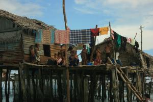
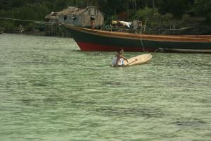
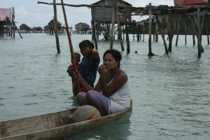
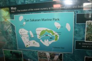
The Celebes Sea off the coast of Sabah is home to one of the last, large groups of sea-gypsies, the ‘Bajau’ people. These sea-nomads are an indigenous, ethnic group with origins probably from the southern Philippines and in the east of Malaysia, they maintain their seafaring lifestyle living aboard boats or on coastal stilt homes. In the west they have largely abandoned their maritime origins and become farmers and horsemen. With a total population in Asia of perhaps around 400,000, in Sabah the Bajau constitute almost 15% of the population with large numbers living in tribal groups on and around the islands and reefs about Pulau Gaya, now the Tun Sakaran Marine Park. They live on their boats and stilt houses, catch fish and barter, grow some crops on the shore, give birth in their boats and huts and live the very basic of lifestyles. They are also stateless, have no national identity, no passports, no (Malay) identity card and no formal access to hospitals, schools or Government support of any kind. They are however, very friendly and were more than happy in welcoming the crazy white people who came bearing gifts.

Bajau boat, Semporna.

From Semporna to Gaya is only about twenty miles and after escaping from the madness of boaty overload outside the harbour at Semporna, we slipped through the reef entrance at Gaya in the early afternoon. We had visited here briefly on the way south ten days earlier, but on this occasion we had organised the time for a look around. So after dropping the pick we slipped across the lagoon to introduce ourselves to the locals; a lot easier now with our native speaker Patsy on board. Along the way we also took the time to marvel at the beauty of the place. Gaya is really quite something and no shock that it is the centrepiece for the quite newish Marine Park. The lagoon gives all the appearance of a caldera with mountainous islands on three sides and coral reefs completing the perimeter of a lagoon two and a half miles across. The water is blue, the islands verdant green with forest and with luck, time and good management the reefs might get back to the pristine conditions that would do justice to the surrounds.

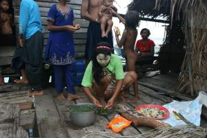
The Bajau village we visited is on the SW side of the island just outside the lagoon and through a shallow entrance between two of the islands; good protection here from the NE monsoon. The most noticeable thing about the Bajau, other than their choice of housing, is the number of small children. One gets the feeling here that with no televisions and DVD players there is only one form of adult entertainment at night and no room for modesty. Their lifestyle is however, really very humble and makes one consider the accumulation of possessions and ‘things’ that seems to occupy much of a western way of life. We came of course equipped with presents and the kids were terribly excited at the sweet treats on offer (really only marginally more than the adults) and the toys. We became quite the centre of attention here with visitors on boats and on foot, on foot here of course meaning a bit of a stroll through waist deep water. Interesting also to watch the preparation of food for dinner, for the more botanically inclined, fish with seaweed (Caulerpa racemosa).

Can you find the boats?

After our sea-gypsy sojourn we were all set for a quiet evening as the only boat in the lagoon when the radio came alive with the Thymers telling us they were just outside after also getting comprehensively sick of the extraordinary Semporna boat noise. With their arrival the mission next day was to climb the mountain overlooking the lagoon and behind the Marine Station on the eastern side. We had plotted this on our previous visit but constant rain and slippery tracks meant the parks people wouldn’t let us. But the next morning was bright and mostly clear and after a tour of the marine station and the obligatory ‘safety’ briefing away we went on our guided tour (the guide cost us ten Ringgit each).

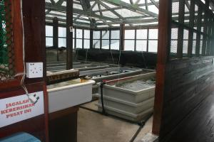
The marine station is apparently dedicated to rehabilitation of the area as opposed to research and the main feature appears to be growing shellfish to put back onto the reef. Figuring large here are giant clams with lots of little clams being grown and fed via algal cultures growing in the next laboratory. The parks management people tell us that they have had the same problem here as in northern Australia in the past where the giant clams have been knocked about with people cutting out the adductor mussel which tastes apparently a lot like crab meat; might explain the bloody great piles of clam shells underwater and next to the Bajau stilt homes!

Not so 'Giant', Giant Clams.

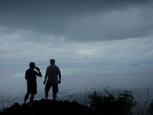
After our tour of the marine station if was off to the top of the island via the parks people’s newly cut mountain, walking track. On walking in the tropics, one thing you can say about climbing hills is that you do get warm, well hot really; one doesn’t need any reminding how close we are to the equator when climbing up mountains, even small ones.  Fortunately this climb wasn’t anywhere near as hard or high as Mt Santubong back in Sarawak but if anything, the views were even more breathtaking. This really is an absolutely stunning part of the world to visit with the most spectacular vistas across jungle covered islands and fringing coral reefs and the boats just the tiniest of specks in the lagoon.  Of course it started to rain at the top of the hill and in between passing, welcome, cool, rain-showers we ate our fruit, drank our water and pondered how fortunate we were to be there.

Here we are!

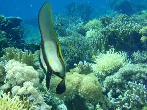
North from Gaya and about 10 miles away is Richards Reef, a circular lagoon of reef, with nothing exposed above the water even on the lowest of tides.  Thyme had come in here a couple of weeks earlier and were keen for a revisit so next morning we dropped our anchors inside the lagoon and went snorkelling on some of best coral any of us had previously seen.  The underwater scenery here is so good we are having trouble understanding why Richards Reef hasn’t been included in the marine park. There is the standard shortage of large fish, but no evidence of blasting (for fishing) that much of the reefs have been subjected to in SE Asia. It may be that the shallow reef here just doesn’t have a large population of biggish fish meaning nobody has gone to the trouble of blowing it up. Either way it is quite something to see and any level of protection would be worthwhile.

Blast fishing or dynamite fishing is the practice of using explosives to stun or kill schools of fish for easy collection. This often illegal practice can be extremely destructive to the surrounding ecosystem, as the explosion often destroys the underlying habitat (such as coral reefs) that supports the fish. The frequently improvised nature of the explosives used also means danger for the fishermen as well, with accidents and injuries.

Although outlawed, the practice remains widespread in Southeast Asia, as well as in the Aegean Sea, and coastal Africa. In the Philippines, where the practice has been well-documented, blast fishing was known prior to World War I, as this activity is mentioned by Ernst Jünger in his book Storm of Steel.One 1999 report estimated that some 70,000 fishermen (12% of the Philippines’ total fishermen) engaged in the practice.

Underwater shock waves produced by the explosion stun the fish and cause their swim bladders to rupture. This rupturing causes an abrupt loss of buoyancy; a small number of fish float to the surface, but most sink to the sea floor. The explosions indiscriminately kill large numbers of fish and other marine organisms in the vicinity and can damage or destroy the physical environment, including extensive damage to coral reefs. (From Wikipedia)

Our program from Richards Reef was to head for Lahud Datu, a large port, town about 32 miles west, so to make the next day easier we departed Richards Reef at 1300 (1.00 PM for the non nautical types) and headed for Pulau Tabawan some 20 miles closer to town.  We arrived at Tabawan not too long before dark and after scratching around looking for something shallower than 20 metres of water finally got to anchor just on dusk in the least marginal of anchorages. During the ‘hunt for a decent anchorage’ Thyme had spied what looked like an easy spot to run aground but not half bad looking reef for a snorkel.  Next morning off we went to check out the potential bottom scraper with Amanda complaining about breaking her rule of never snorkelling off mangrove habitats (here there probably be crocodiles). The reef here was okay, but obvious also and sadly was the bane of SE Asian coral reefs with patches of blasted reef all over the shop.  Apparently we had better get used to this before heading into the Philippines.

Patsy and Geoff; cooking, cooking, cooking!

Markets; Lahud Datu.

Lahud Datu was the next destination and home for a few days and around mid-day on October 27 we slipped quietly past the big fishing traps and palm oil ships to put down the pick just off the police dock and town centre. A crew change was in the wind here with Geoff and Patsy heading off to see Patsy’s family over near KL and British Lucy joining the boat for the passage back around to Sandakan.

Legend has it that in the days of yore the sea-gypsies would only ever go ashore to bury their dead. In the circumstances why they would bother to do that seems odd but either way and even today, on sea, on land, with or without a boat, it does look like a tough life.

Sea Gypsies; the Bajau people of the Sulu and Celebes Sea.

Boat of the Bajau Laut.

The Bajau or Bajaw also spelled Bajao, Badjau, Badjaw, or Badjao, are an indigenous ethnic group of Maritime Southeast Asia. Bajau continue to live a seaborne lifestyle, making use of small wooden sailing vessels (known as perahu) for voyages through the seas of austronesia.

Due to escalated conflicts in their native Sulu Archipelago, and discrimination in the Philippines with regards to education and employment, most of the Bajau have migrated to neighboring Malaysia over the course of 50 years. Currently they are the second largest ethnic group in the state of Sabah, making up 13.4% of the total population. Groups of Bajau have also migrated to Sulawesi and Kalimantan in Indonesia, although figures of their exact population are unknown.

Bajau have sometimes been referred to as the Sea Gypsies, although the term has been used to encompass a number of non-related ethnic groups with similar traditional lifestyles, such as the Moken of the Burmese-Thai Mergui Archipelago and the Orang Laut of southeastern Sumatra and the Riau Islands of Indonesia. The modern outward spread of the Bajau from older inhabited areas seems to have been associated with the development of sea trade in sea cucumber (trepang).

Bajau is a collective term, used to describe several closely related indigenous groups. These Bajau groups also blend culturally with the Sama groups into what is most properly called the Sama–Bajau people. Historically the term “Sama” was used to describe the more land-oriented and settled Sama–Bajau groups, while “Bajau” was used to describe the more sea-oriented, boat-dwelling, nomadic groups. Even these distinctions are fading as the majority of Bajaus have long since abandoned boat living, most for Sama–style piling houses in the coastal shallows. Today, the greatest feature distinguishing the “Bajau” from the “Sama” is their poverty.

History

The origin of the word Bajau is not clear cut. It is generally accepted that these groups of people can be termed Bajau, though they never call themselves Bajau. Instead, they call themselves with the names of their tribes, usually the place they live or place of origin. They accept the term Bajau because they realize that they share some vocabulary and general genetic characteristic such as in having darker skin, although the Simunuls appear to be an exception in having fairer skin.

British administrators in Sabah, labeled the Sama as Bajau and put Bajau in their birth certificates as their race. During their time in Malaysia, some have started labeling themselves as their ancestors called themselves, such as Simunul. For political reasons and to ensure easy access to the Malaysian special privileges granted to Malays, many have started calling themselves Malay. This is especially true for recent Filipino migrants.

For most of their history, the Bajau have been a nomadic, seafaring people, living off the sea by trading and subsistence fishing. The boat dwelling Bajau see themselves as non-aggressive people. They kept close to the shore by erecting houses on stilts, and traveled using lepa-lepa, handmade boats which many lived in. Although historically originating from the southern Philippine coasts, Sabahan Sama legend narrates that they had originated from members of the royal guard of the Sultan of Johor, after the fall of the Malay Malacca empire, who settled along the east coast of Borneo after being driven there by storms. Another version narrates that they were escorting the Sultan’s bride, but the bride was later kidnapped by the Sultan of Brunei. The fact that the Bajau-Sama languages belong to the Philippine branch of Malayo-Polynesian languages would substantiate the anthropological origins of the Bajau groups to be from the Philippines, and put the origin legends down to the historic Malay-centric influence of Bajau culture.

However, there are traces that Sama people came from Riau Archipelago especially Lingga Island more than 300 years ago. It is believed by some that the migration process of Samah to North West Borneo took place more than 100 years earlier, starting from trade with the Empire of Brunei. With the fall of the legitimate Sultan of Johor due to being overthrown by Bugis immigrants, Sama people fled to the west coast of North Borneo where they felt safe to live under the protection of the Brunei Sultanate. That’s why native Kadazan-Dusun call Sama people as “tuhun (people of) Sama” or “tulun (people of) Sama” in their dialects, the form of recognition before western civilization found Borneo. It was believed that Sama people are not from the royalty of the Sultanate, but loyal workers, craftsmen, boat builders and farmers that fled from cruelty of ethnic cleansing in chaotic Johor during aggression of the Bugis taking over the throne of Johor.

Today the number of Bajau who are born and live primarily at sea is diminishing, partially due to hotly debated government programs which have moved Bajau on to the mainland.Currently, there exists a huge settlement of Filipino Bajau in Pulau Gaya, off the Sabah coast. Many of them are illegal immigrants on the Malaysian island. With the island as a base, they frequently enter Sabah and find jobs as manual laborers.

Discrimination of Bajau (particularly from the dominant Tausūg people who have historically viewed them as ‘inferior’ and less specifically from the Christian Filipinos) and the continuing violence in Muslim Mindanao, have driven many Bajau to begging, or to migrate out of the country. They usually resettle in Malaysia and Indonesia, where they are less discriminated against.

Demographics and religion

The various Bajau sub-groups vary culturally, linguistically, and religiously. Religion can vary from a strict adherence to Sunni Islam, forms of folk Islam, to animistic beliefs in spirits and ancestor worship. There is a small minority of Christians.

Beneath the Wind. Turtles, monkeys and oil rigs! Kudat to Semporna. 08 – 24 October 2011.

October 29, 2011

Tigabu

The North-Eastern part of Malaysian Borneo, ‘Sabah’ is often referred to as “The land below the wind”, because of its location just south of the typhoon-prone region around the Philippines. North of Sabah the typhoons (tropical revolving storms or cyclones for the antipodeans amongst us) move east to west across the Philippines. Whilst some of these cyclones dip south across Palawan (southern Philippines), there is not enough coriolis to let them operate this far south. So, for the intrepid boaty types amongst us this is a good time to have a look at the coast of Sabah while waiting for the more ‘non-cyclone’ season and to then move further north into the Philippines. In Sabah one can day hop all the way to the Indonesian border about 300 miles around the coast from Kudat headed east and south.

First stop out of Kudat was Pulau Banggi actually north of Kudat where we slipped in for a quiet night in the very beautiful Milford Haven. Not wanting to waste too much time next morning and not too early we headed for an island stop at P. Tigabu and anchored off one of the ubiquitous native villages that either cling to the coast of the little islands all through here or park themselves on piles above the water. Tigabu is something of the standard little fishing island but like all the others one wonders where they get their water from. From Tigabu to P. Lankayan is 26 miles and on this island there is the ‘Lankayan Island Dive Resort’, apparently the self proclaimed ‘Paradise Island of the Sulu Sea’.

We're free!!!

The island itself is quite small and advertises itself as an ‘Eco-Resort’ and comes fully equipped with a fellow titled the ‘Reef Guardian’; we did spend some time wondering how they get rid of rubbish and more pertinently their sewage, but anyway. It is very nice however and they have a turtle hatchery here, hoping it would seem, to do something about helping the turtle numbers recover in this part of the world. Having your own turtle hatchery does of course lend itself to spruking environmental credentials in spite of and ironically the resort having to be built in the first place on top of a significant haul out site for the turtles.

Having the resort there does however slow down the illegal removal of the turtle eggs from the beach. Apparently it is now illegal to catch turtles or dig up their eggs in Malaysia but it’s not too difficult to spot the (black market) fellows on the roads outside of towns letting you know they have turtle eggs for sale. Either way it is encouraging to see some sort of conservation moves happening given the state of rapacious development one sees all through Borneo.

Sandakan

We spent two nights on Lankayan in company now with English Andy (Shah) who was also island hopping down towards the diving hotspot of Mabul and nearby Sipidan islands. On Lankayan and in the spirit of protecting coral they have provided moorings for passing yachties and given the depth of water even close in (20 metres), here a mooring is always handy. You do however need to check moorings at times and after being woken that night by a passing, very nasty squall off a very ‘lee’ shore, Trevor was mortified to find the Gadfly swinging on one little, tiny strand of a very damaged nylon rope; yep, move moorings immediately!

The islands all through this part of Borneo are really quite beautiful with the obligatory white, coral-sand beaches, clear water that away from the coast takes on that lovely deep blue colour and there are even fish here to be caught. Geoff is very keen on the fishing and between Banggi and Sandakan we managed to catch three Spanish mackerel and two barracoutta. One of the barracouta was kind of big and took thirty minutes to get in; both went back. From Lankayan we headed for the bright lights of Sandakan and after a lunch stop on Shah out between the reefs (barbecued Spanish Mackerel) we put down the pick in front of the yacht club to spend three days doing the restaurants on the sea-front, fresh-water, swimming pools and road trips.

One of the things one has to do here is visit to the ‘Agnes Keith’ home/museum and tea house on the hill. Agnes was a writer married to the ‘Conservator of Forests’ (now that’s ironic, bring him back) before during and after the war who wrote about life in Borneo and as a prisoner of the Japanese. If you listen intently you might still hear the sounds of the British colonial era here, the clink of the gin and tonics and the clunk of the croquet balls!

Having tea; Sharon (Andy's crew), Geoff, Trevor, Andy.

There are also a few interesting conservation areas out of Sandakan, one of them the obligatory Orang-utan reserve ‘Sepilok Orang-Utan Rehabilitation Centre’ (they always seem to be rehabilitating the Orang-Utans), another the, Rain-forest Discovery Centre and the privately run ‘Proboscis Monkey Sanctuary’ where one can get close up and personal with Proboscis monkeys. Of all the monkeys these are probably the most chilled and laid back with people around; unlike the macaques who spend an inordinate amount of time aggressively hassling for food or anything that might potentially be food. Whilst at the Proboscis Monkey place we sat through a film outlining how the area came to be protected. It seems the local Chinese developers, after cutting and bulldozing most of the area for palm oil decided the small strip of mangroves along the shoreline could be left for the monkeys; palm oil probably doesn’t do very well in saline ground-water one guesses. The only problem is that most of the monkeys foraging range (they eat leaves mostly and rely on the mangroves)  has been cleared and the monkeys would now appear to be heavily reliant on the sugar free pancakes provided by the reserve. This does of course provide an excellent way to guarantee monkeys for ones new nature-reserve, viewing area (60RM entry and 10RM per camera), all accompanied of course by much back slapping and self congratulation (in the film). However and once again, something is better than nothing.

Bill

After our three days at Sandakan and with now just Trevor and Geoff on board (Ana having headed for the diving hotspots of Mabul and Sipidan) we headed for ‘Dewhurst Bay’, a really quite shallow entranced bay that provides the northern entry for the Kinabatangan River. We were only going as far as just inside but after advice from the Thymers we manned Andy’s dinghy for a trip up the nearby creek/little estuary to spot some wild(er) proboscis monkeys in yet another residual nature reserve.

Tun Sakaran Marine Park. P.Gaya.

From Dewhurst to Tambisan island was another day hop to anchor off another fishing Kampong. The next day was a longer 65 mile hop to Pulau Gaya in the Tun Sakaran Marine Park where we once again met up with Thyme (Simon, Amanda, Sloop and the Chilean couple Manne and Christian). The next day we slipped two miles across to Pulau Maiga where we stopped opposite a sea-gypsy village for the night. Next day we were visited by a (little) canoe full of local kids touting sea-shells for exorbitant prices; ah well they are doing their best. Of course buying a couple of shells then meant quite the flotilla of boats heading out to get some money from the crazy boaties.

The weather next day (Thursday Oct20) turned somewhat pear-shaped so in rain, close hauled most of the way and in company with Shah we dodged around the reefs and headed for Mabul, apparently one of ‘the’ diving destinations in the known universe. Quite the place Mabul, loads of resorts built out across the water, dive boats zigging and zagging all over the shop, loads more resorts on shore and when in doubt park an oil-field, accommodation platform just offshore as yet another diving operation.

It seems the go here is to find a place that fits the bill for world heritage status then over-develop, trash the place and don’t stop building until there is no room left; shades of Thailand really. It all seems a bit ironic that many of the divers who come here to experience their bit of underwater-spectacular seem blind to the crass over development that has preceded them and will follow; probably spending to much time staring into the dive computers they were wearing in the dining room and bar in the evening! Quote from Geoff, “Maybe they could wear their aqualungs as well”? On the upside most of the dive companies appear to be promoting an environmental message re: reefs, fish, sharks and rubbish.

Having decided that Mabul was not the go for these sailors and not wanting to risk falling into the cult of PADI, we upped anchor the nest morning for the twenty odd miles to Semporna.  This entailed a twelve mile run in the channel up inside Beaufort Reef to finally anchor just off the harbour entrance at Semporna amidst what seems to be a million noisy boats and possibly the worlds largest collection of floating rubbish; probably an over-statement but not by much. On the boats, these are mostly the little, small, go fast variety we saw so many of back in Kota Kinabulu that seem to provide the equivalent of cars in more land based locations. There are literally thousands of little houses parked on and over the water in this part of the world and every family has a least one boat and usually more than one. The result is the noisiest cacophony of un-muffled engine noise imaginable accompanied by total chaos. Being so close to the divers heaven of Sipidan there are also subsidiaries here of the PADI cult here with divers being ferried out each day from the very busy Semporna, water- front.

Semporna town jetty!

Boats and more boats.

A happy day for Kiwis.

The Gadfly's refueling.

The plan was to spend three days here, long enough to pick up Geoff’s partner Patsy from Tawau, watch the rugby world cup final and buy food and diesel before heading north out into Darvel Bay. Patsy arrived in time to start making spectacular inroads into improving the Gadfly culinary capabilities while the world cup was a spectacular success for our cousins on the eastern side of the Tasman Sea; Simon was so happy it was breathtaking and Amanda is none too pleased with French lack of sportsmanship. Getting diesel was easy with the local lads carrying the jerries in wheelbarrows back to the town jetty. This went swimmingly for the Gadfly refuel but Amanda unhappily managed to come across the Semporna equivalent of the ‘Artful Dodger’ resulting in much heartache over issues of payment; note to oneself, always pay at the end!  On the twenty fourth we extricated our anchor from the piles of debris on the bottom and headed out to revisit Tun Sakaran and try and climb the mountain at the back of the park headquarters.

Patsy and Geoff.

Amanda, the 'Artful Dodger' and hangers on.

How things happen sometimes!!!

Sabah is one of 13 member states of Malaysia. It is located on the northern portion of the island of Borneo. It is the second largest state in the country after Sarawak, which it borders on its southwest. It also shares a border with the province of East Kalimantan of Indonesia in the south. In spite of its status as a Malaysian state, Sabah remains a disputed territory; the Philippines has a dormant claim over much of the eastern part of the territory. The capital of Sabah is Kota Kinabalu, formerly known as Jesselton.

During the 7th century CE, a settled community known as Vijayapura, a tributary to the Srivijaya empire, was thought to have been the earliest beneficiary to the Bruneian Empire existing around the northeast coast of Borneo. Another kingdom which suspected to have existed beginning the 9th century was P’o-ni. It was believed that Po-ni existed at the mouth of Brunei River and was the predecessor to the Sultanate of Brunei.

The Sultanate of Brunei began after the ruler of Brunei embraced Islam. During the reign of the fifth sultan known as Bolkiah between 473–1524, the Sultanate’s thalassocracy extended over Sabah, Sulu Archipelago and Manila in the north, and Sarawak until Banjarmasin in the south. In 1658, the Sultan of Brunei ceded the northern and eastern portion of Borneo to the Sultan of Sulu in compensation for the latter’s help in settling a civil war in the Brunei Sultanate. In 1749, the Sultanate of Borneo ceded southern Palawan to Spain.

In 1761, Alexander Dalrymple, an officer of the British East India Company, concluded an agreement with the Sultan of Sulu to allow him to set up a trading post in the region, although it proved to be a failure. In 1846, the island of Labuan on the west coast of Sabah was  ceded to Britain by the Sultan of Brunei and in 1848 it became a British Crown Colony. Following a series of transfers, the rights to North Borneo were transferred to Alfred Dent, whom in 1881 formed the British North Borneo Provisional Association Ltd. In the following year, the British North Borneo Company was formed and Kudat was made its capital.

In 1883 the capital was moved to Sandakan. In 1885, the United Kingdom, Spain, and Germany signed the Madrid Protocol of 1885, which recognised the sovereignty of Spain in the Sulu Archipelago in return for the relinquishment of all Spanish claims over North Borneo. In 1888 North Borneo became a protectorate of the United Kingdom. The Sultanate of Sulu was granted the north-eastern part of the territory as a prize for helping the Sultan of Brunei against his enemies and from then on that part of Borneo was recognised as part of the Sultan of Sulu’s sovereignty.

In 1878, Baron Von Overbeck, an Austrian partner representing The British North Borneo Company and his British partner Alfred Dent, leased the territory of Sabah. In return, the company was to provide arms to the Sultan to resist the Spaniards and 5,000 Malayan dollars annual rental based on the Mexican dollar’s value at that time or its equivalent in gold. This lease was continued until the independence and formation of the Malaysian federation in 1963 together with Singapore, Sarawak and the states of Malaya. As of 2004, the Malaysian Embassy to the Philippines had been paying cession/rental money amounting to US$1,500 per year (about 6,300 Malaysian Ringgits) to the heirs of the Sultanate of Sulu.

Boat maintenance in exotic locations, haul out, anti-foul and repairs in Kudat. 28August to 08 October.

October 22, 2011

There is only so many times you want to get underneath a boat and scrape off the critters that like attaching themselves to your floating home and after three months of the weekly ritual of cleaning the water line and detaching barnacles, the long overdue haul-out had to happen. The plan had been to get the boat up way back in Thailand or at least Langkawi, but better things to do beckoned along the way. Kudat had been recommended by a lot of the passing yachtie throng so up we were, once again fulfilling the oft quoted adage; cruising = boat maintenance in exotic locations. Of course it hadn’t helped that back in Johor the lads from Danga Bay who scraped the equivalent of Minerva Reef off the bottom used their razor sharp scrapers with so much enthusiasm that along with the boats personal, marine, ecosystem they scraped off most of the remaining anti-foulant.

One of the ongoing dilemmas with cruising is prioritising the multitude of jobs that need to be done, (hmm how important is that, will we sink?). The usual way is to cross jobs off the top of the list as you add more tasks to the bottom, in other words it never stops. So there we were, sanding, epoxy painting, anti-fouling, new skin-fittings, painting, sealing chain lockers, etc etc, the usual life of the intrepid sailor, same jobs, different country, interesting yard.

Sand blasting!!!!

The yard in this case was, Penuwasa, run by the local Chinese and set up for the local fishing fleet; big travel-lift, outdoor workshop, clouds of sand from the very noisy sand-blasting, lots of rubbish, the resident pack of dogs, dirt/mud to walk/splash around in, ladders that are designed to terrify and a symphony of chain saws.  The standard tools here for the shipwrights are adze (sort of a chisel/axe combined), an electric plane and a good chain saw, but they are very good with those chain saws. This is big timber repairs and with a sharp chain-saw they can cut their chosen pieces of rain-forest to absolute perfection, spectacular really. The pack of dogs was great and of course, like usual, for a while there one of them adopted Trevor and the Gadfly. During the day and in the heat (and it is hot in that yard) the dogs generally loitered and slept on their own underneath the various boats, then about an hour before dusk they formed up for the pack thing. The community here is of course mainly Moslem and there is a mosque about 100 metres from the yard with call-to-prayer five times a day. The most interesting was the dawn call and when the singing/call started from the mosque the dogs each time responded with unified howling.

That Mosque.

It took about two weeks to finish the multitude of jobs with the only real source of anxiety being the sand blasting that started thirty metres away, just when Trevor was trying to get all the paint back on the bottom of the boat. The big trawler they were trying to resurrect had all the appearance of having just been hauled off the bottom of the Sulu Sea and the lip service to preventing clouds of sand wafting about the yard was about as effective as wearing slippers to keep your feet dry in a rain storm. Every afternoon when the wind changed the boat took on the look of having just crossed the Great Sandy Desert.

The work continued once back in the water with repairs and painting on deck, rigging repairs, fixing instrument problems, the usual stuff. On the eighteenth Trevor flew back to Aus for a visit and on October 6 flew back with bags of boat parts and (can you believe it), cheese cultures that Amanda had ordered from somewhere and had delivered to his mother; this of course then required an ongoing availability of refridgerators and freezers. On the sixth new crew arrived in the form of Geoff from Perth and Anna from Spain; Geoff is originally from Wales now enjoying the life of sun and surf in SW Australia while Anna is currently running her own restaurant in Guatemala. On the morning of the eighth we pulled our anchors out of the mud in the lagoon and headed out for places south.

Coral atolls in the South China Sea. Does it get any better?

October 13, 2011

Layang Layang; Swallow Reef.

Imagine a coral atoll parked on top of a sea-mount, seven kilometres around with the clearest water imaginable dropping from a fringing reef to 1500 metres, nearly vertical. Then throw in the obligatory large, pelagic fish that love this sort of location, a few sharks, some turtles and all the other accoutrements of a ‘healthy’ coral reef and this is Layang Layang.  All of the rumours had suggested this was one of the places to visit off Borneo and if you are diver they were absolutely right. The diving here is simply stunning with the clearest oceanic water that any of us had seen.  Sadly the hammer- head sharks weren’t about or any of the whale-sharks and manta-rays that we keep hearing about, but then you can’t have everything.

For ten days the lagoon was to be home to the good ships Gadfly and Thyme with the only other boats to keep us company a big South African catamaran and the Malaysian Navy war-ship stationed out there. Well war-ship may be a bit of an embellishment, perhaps more ‘patrol-boat’, but it did have a very large gun on the front of it. The navy base here is pretty much off limits to visitors with signs suggesting anybody taking photos might be in a great deal of trouble, one does wonder though what constitutes trouble at LL as most things are pretty laid back? The sailors were really very friendly and more than happy to help us out with some water and to detail a couple of personnel to help carry the water back to our dinghy; the base Commanding Officer even came down to have a chat as we filled our jerry cans.

Special forces,

Special Forces Fishing Team (SFFT).

Ivonne.

Amanda just above the drop off.

Amanda on the drop off.

As far as Navy bases go, this one thinks doesn’t really rate as a hardship posting with sandy beaches, blue water, warm days every day, bbq’s, volley-ball, fishing etc etc. There is also a big mural on the side of one of their buildings here celebrating their ‘special forces’ acumen and ever afternoon the Navy ‘Special Forces Fishing Team’ (SFFT) would sally forth on operations to teach those fish who was firmly in charge out here. On fishing, the inside of the lagoon is a marine park (hence the requirement to not anchor but rather secure to the aircraft carrier moorings) but one is allowed to fish outside the lagoon and the fishing is also very good. Simon, the original fish slayer, caught a large ‘dog-tooth’ tuna on his first sortie, and eventually worked out that the ‘giant trevally’ (GT’s) have a love affair with the entrance and every night around dusk one is almost guaranteed fish while trolling from the dinghies. Sharks were a bit active here also and Trevor managed to catch on a single lure and at the same time a GT and the head of a barracuda that had recently suffered decapitation by shark. Another barracuda lost most of it’s body about three seconds after taking the lure with the head still twitching when pulled in.

Simon and his 'dog-tooth' tuna. Happy boy.

Trevor and GT's.

The only real problem out at LL however is that other than eating, reading, swimming, snorkelling, diving, fishing and the occasional walk on the tiny strip of land that the navy and diving resort call home, there isn’t much else to do; not really a dilemma but anyway! To break up this apparent monotony Amanda suggested to the resort that if they provided some garbage bags we would clean all (that we could) rubbish off the little sandy beach near the lagoon entrance.  The resort at LL we had been warned would not even think of selling us a can of Coke, but, after blinking several times and looking confused, the girl at the desk was forthcoming with some large plastic bags. The idea became, you clean the beach, leave the full bags under the rotunda and the Navy will come down and pick them up. Ah yes, something of a transfer of responsibility there!

A beach of bottles!

Niel and those bottles.

Simon and his bottles!

Like the rest of South-East Asia most of the rubbish here is plastic, largely thongs and shoes and the ubiquitous plastic water bottles. There are in fact so many water bottles sculling around this part of the world that if an alien came to Earth here they would have to assume that plastic water bottles are the dominant life form (in the Andaman Islands this would be ‘thongs’ or for non-Australians ‘flip-flops’). How so many plastic bottles manage to wash up on a little beach in LL is, however, something of an enduring mystery.

Anyway after picking up about fifteen large bags of said plastic bottles we deposited them all under the little rotunda and reflected proudly on our attempt to improve our then little corner of the world; bet the bags are still there next year! Next to our little beach was a sign proclaiming proudly a ‘mangrove revegetation program’ currently underway in front of the beach. Well the little tubes are there but one assumes that such dubious scientific activities are more focussed on supporting the territorial claims of Malaysia to this little bit of the Spratly Islands, i.e. ‘look what good things we are doing’! What they were thinking trying to grow mangroves here god only knows. On other entertaining events, while we were engaged in our beach, cleaning program one of the resort staff arrived with a little tractor pulling a small trailer. The assumption at the time was that he was there to collect the rubbish but his explanation to Trevor when asked was, “No, I am just here to see what you are doing”!  One assumes that crazy white people picking up other peoples rubbish has to be seen to be believed.

The really good weather at LL lasted for the first five days and the following burst of intermittent and less than friendly weather coincided with the Gadfly SCUBA compressor developing a very loud banging noise bringing an end to our diving adventures; bit timely you might say. The weather was also definitely less than brilliant when we were due to leave and on the twenty fourth and under threatening skies, rain and a somewhat squally outlook we slipped away early from our man-of-war moorings for the 180 odd miles to Kudat, just around the most northerly tip of Borneo. The weather did however improve as we moved south with good winds. On the twenty fifth we had a great sail under kite, poled out headsail, full main and mizzen, whilst watching nervously for squalls. Late on the afternoon of the twenty fifth we put down our pick in a bay just north of Kudat and on the morning of the twenty sixth we secured to the wall in the pond next door to the Kudat shipyard. The next day both boats were hauled out for the obligatory bottom clean.

The top of Borneo.

A BBQ in the South China Sea: Palau Gaya and leaving KK.

October 6, 2011

Gadfly on passage to the 'Spratlys'. Photo - Ivonne.

 We had been at KK for three weeks and were pretty keen to head off for Layang Layang which was to be our next destination of note before we headed to Kudat for the obligatory haul out and anti-foul. The only problem was we had told the Malaysian Navy we wouldn’t be there until the fifteenth and then thirteenth, so the decision was we had better have a BBQ. The plan was to get away from our fisherman’s anchorage on the tenth, have a very laid back afternoon and evening on the beach at ‘Police Bay’ on Palau Gaya, chill out for another day and then head for Layang Layang on the twelfth with an overnighter on the way out. So at lunchtime on the Wednesday and after a morning shopping at the markets we slipped away to the north-east for the terribly exhausting 5 mile passage to our BBQ anchorage.
 

Big, black and sneaky!


For our beach soiree we had three boats crews, Amanda, Simon and Ivonne on Thyme (Sloop also of course), on Metana, Daryl, Marjory and Mena and on the Gadfly, Trevor, Neil and Gabrielle.  Neil from the UK has been on the road for several years and had arrived from a stint teaching English in Korea while Kiwi Gabrielle was on leave from her job primary teaching in KL. Daryl was in charge of the steak situation having marinated the local stuff in Papaya, while the other two boats put together anything else that seemed appropriate for the occasion. On the way out the locals laid on a submarine escort to honour us all (appropriate really) but they did keep their distance, probably and with good reason out of concern that we might run into them. We have no idea at all who the submarine belongs to but it was big and very black.

From Police Bay.

Amanda and Daryl.


Next morning Daryl headed back into Sutera to continue his watch over Farmer Dave’s boat (gone to Thailand he had) while Thyme and Gadfly slipped into the next bay north for a change of scenery.  There is a resort in this bay that apparently doesn’t like grubby yachties and does it’s collective best to discourage them from even coming ashore, let alone use any of their facilities; but, they have a swimming pool. That afternoon Simon, Gabrielle and Trevor decided that a swim was in order and while Simon and Trevor surreptitiously (blatantly really) slipped into the pool Gabrielle ordered a drink and was very nicely told the guests get their first drink for the evening free, well cocktails all round then wasn’t it!  In our new status as guests we decided to have a good look at the place and after getting directions to the ‘Spa’ huts, Trevor was all fired up to get some more drinks and fill the local hot tub but was (probably wisely) talked out of it by Simon.

Cocktails next!

Our planned departure for Layang Layang on the Friday was for 6.0 AM (0600 for the more nautical inclined) so bright and early next morning off we went headed around Tanjung Bulijong to steer as close to 302 degrees as we could manage for the 155 mile passage to the entrance at Layang Layang (also known as Swallow Reef). Layang Layang is a coral atoll that sits on a sea-mount out in the ‘Spratly’ group of islands west and north-west of Borneo. Nobody seems to actually own these islands but everybody up here says they do with much arguing between Malaysia, Vietnam, China etc etc.  Anyway Malaysia has a Naval Base and airstrip on this particular one which makes it a good option to visit as long as you get permission from Malaysia.

Layang Layang entrance 1500 metres to 8 metres!

Anchored inside.

The passage out to took us about 33 hours with the mandatory squalls and close hauled on port whenever there was actually very much wind. Always exciting it is to make landfall after any sort of passage out of sight of land and no exceptions here; especially as we had heard much to be even more excited about with regard to this landfall. This atoll rises from abruptly from around 1500 metres and the reef enclosing the lagoon at high tide barely sticks out of the water; or doesn’t at all. Inside the lagoon the depths are around four to 10 metres and there is a sand spit at the North-Eastern end where the Navy has their home.  There is also yet another little resort that operates during the SW monsoon providing dive trips to the more financially endowed members of the diving fraternity. The sales-pitch here is ‘The best diving in the world’ and at this establishment they wouldn’t even sell us a can of Coke; no confusion at all on where we fitted in! Anyway it was good to get inside and get the pick down whilst coming in at the entrance and marvelling at the depth sounder going from no-result (too deep) to 8 metres whilst moving forward about 10 metres. Of course the Navy quickly told us we had to move onto some nearby moorings that are big enough to secure a Destroyer to; this meant of course we were to later spend a lot of time keeping our boats from drifting into them when there was no wind; does wonders for the paint work and all. But my, the water is clear.

Naval support!
Those moorings!
Neil

More when we get to Kudat. From the Gadfly at:  07 24.872N 113 47.846E.

Tough life!!!!!